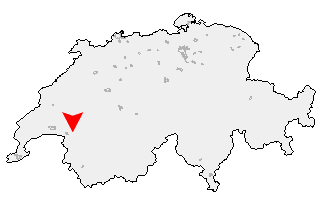
Suche
Ihre Position: Startseite - Waadt - Blonay

Blonay

Kategorie: Stadt / Gemeinde
Kanton: Waadt
Regierungsbezirk: District de la Riviera-Pays-d'Enhaut
amtlicher
Gemeindeschlüssel:

G5881
Einwohner: 4.695
Fläche: 160,40 km²

Postleitzahl (PLZ): 1807

Entfernung berechnen (zu einer anderen Stadt)
Blonay bei Wikipedia   Blonay bei Google Maps


Karte von Blonay

Klicken Sie auf die Karte, um nach Städten im Umkreis zu suchen.
(Sie können die Karte auch in Ihre Internet-Seite einbinden.)

Fügen Sie in den HTML-Code Ihrer Seite einfach folgenden Code ein:
<a href="https://ch.postleitzahl.org/waadt/blonay/" target="_blank"><img src="https://ch.postleitzahl.org/waadt/images/karte_blonay.png" alt="Blonay"></a>


Städte im Umkreis von Blonay


Ecublens (FR) (19.21 km) Saint-Saphorin (Lavaux) (10.73 km)
Chapelle (Glâne) (16.45 km) Les Thioleyres (12.3 km)
Saint-Gingolph (15 km) Auboranges (15.59 km)
Vuibroye (14.51 km) Granges (Veveyse) (11.26 km)
Châtillens (13.67 km) Les Tavernes (12.77 km)
Oron-la-Ville (14.27 km) Rue (17.5 km)
Chardonne (8.67 km) Corseaux (7.98 km)
Palézieux (11.25 km) Oron-le-Châtel (12.86 km)
Roche (VD) (14.52 km) Jongny (6.84 km)
Bossonnens (8.88 km) Vevey (6.33 km)
Chesalles-sur-Oron (12.84 km) Ecoteaux (9.94 km)
Attalens (7.29 km) Port-Valais (12.92 km)
Corsier-sur-Vevey (5.76 km) Bussigny-sur-Oron (11.26 km)
La Tour-de-Peilz (4.98 km) Le Flon (15.11 km)
Vouvry (15.86 km) Maracon (9.82 km)
Remaufens (7.97 km) Saint-Martin (FR) (12.85 km)
Saint-Légier-La Chiésaz (3.52 km) Noville (10.76 km)
Chessel (14.05 km) Rennaz (10.88 km)
La Verrerie (13.92 km) Blonay (0 km)
Semsales (10.91 km) Châtel-Saint-Denis (5.53 km)
Yvorne (15.03 km) Veytaux (5.6 km)
Montreux (3.97 km) Villeneuve (VD) (8.18 km)
Corbeyrier (12.89 km) Vaulruz (16.46 km)
Vuadens (16.21 km) Leysin (15.08 km)
Haut-Intyamon (8.22 km) Le Pâquier (FR) (15.43 km)
Bulle (17.86 km) Rossinière (10.15 km)
Ormont-Dessous (15.04 km)