

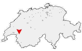
Klicken Sie auf die Karte, um nach Städten im Umkreis zu suchen. (Sie können die Karte auch in Ihre Internet-Seite einbinden.) |
Fügen Sie in den HTML-Code Ihrer Seite einfach folgenden Code ein: <a href="https://ch.postleitzahl.org/waadt/caux/" target="_blank"><img src="https://ch.postleitzahl.org/waadt/images/karte_caux.png" alt="Caux"></a> |
Städte im Umkreis von Caux |
|
| Ollon (17.58 km) | Vionnaz (14.43 km) |
| Aigle (13.53 km) | Vouvry (11.73 km) |
| Yvorne (10.7 km) | Leysin (11.24 km) |
| Chessel (9.83 km) | Roche (VD) (10.87 km) |
| Corbeyrier (8.73 km) | Port-Valais (9.19 km) |
| Saint-Gingolph (12.06 km) | Rennaz (6.57 km) |
| Ormont-Dessous (12.37 km) | Noville (6.68 km) |
| Villeneuve (VD) (4.35 km) | Veytaux (2.41 km) |
| Montreux (2.65 km) | La Tour-de-Peilz (5.27 km) |
| Vevey (7.14 km) | Rossinière (10.73 km) |
| Corseaux (9.03 km) | Blonay (4.36 km) |
| Saint-Saphorin (Lavaux) (11.87 km) | Jongny (8.88 km) |
| Chardonne (10.46 km) | Saint-Légier-La Chiésaz (6.88 km) |
| Corsier-sur-Vevey (8.44 km) | Haut-Intyamon (10.55 km) |
| Attalens (10.55 km) | Châtel-Saint-Denis (9.84 km) |
| Granges (Veveyse) (14.01 km) | Bossonnens (12.23 km) |
| Remaufens (11.97 km) | Les Thioleyres (15.31 km) |
| Ecoteaux (13.7 km) | Palézieux (14.84 km) |
| Les Tavernes (16.09 km) | Maracon (13.91 km) |
| Châtillens (17.05 km) | Bussigny-sur-Oron (15.26 km) |
| Vuibroye (18.01 km) | Oron-le-Châtel (16.71 km) |
| Semsales (15.27 km) | Oron-la-Ville (17.86 km) |
| Chesalles-sur-Oron (16.81 km) | |