

Klicken Sie auf die Karte, um nach Städten im Umkreis zu suchen. (Sie können die Karte auch in Ihre Internet-Seite einbinden.) |
Fügen Sie in den HTML-Code Ihrer Seite einfach folgenden Code ein: <a href="https://ch.postleitzahl.org/waadt/le_brassus/" target="_blank"><img src="https://ch.postleitzahl.org/waadt/images/karte_le_brassus.png" alt="Le Brassus"></a> |
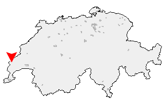
Städte im Umkreis von Le Brassus |
|
| Saint-Cergue (16.27 km) | Arzier (11.09 km) |
| Bassins (10.43 km) | Le Chenit (1.05 km) |
| Marchissy (9.71 km) | Le Vaud (11.32 km) |
| Longirod (9.32 km) | Begnins (15.29 km) |
| Saint-George (7.68 km) | Burtigny (12.82 km) |
| Luins (16.34 km) | Vinzel (15.2 km) |
| Le Lieu (9.98 km) | Bursins (15.45 km) |
| Gimel (8.81 km) | Saint-Oyens (11.53 km) |
| Gilly (15.22 km) | Bursinel (17.16 km) |
| Tartegnin (14.94 km) | L'Abbaye (9.27 km) |
| Essertines-sur-Rolle (13.14 km) | Bière (8.57 km) |
| Saubraz (11 km) | Berolle (8.43 km) |
| Rolle (16.01 km) | Mont-sur-Rolle (15.02 km) |
| Mollens (VD) (9.15 km) | Pizy (13.98 km) |
| Bougy-Villars (14.82 km) | Montherod (13.45 km) |
| Perroy (16.63 km) | |