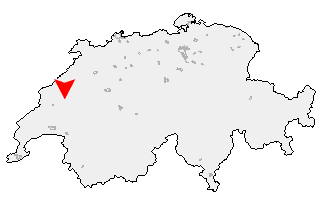
Suche
Ihre Position: Startseite - Freiburg - Châtillon (FR)

Châtillon (FR)

Kategorie: Stadt / Gemeinde
Kanton: Freiburg
Regierungsbezirk: District de la Broye
KFZ-Kennzeichen: FR
amtlicher
Gemeindeschlüssel:

G2008
Einwohner: 274
Fläche: 13,10 km²

Postleitzahl (PLZ): 1473

Entfernung berechnen (zu einer anderen Stadt)
Châtillon (FR) bei Wikipedia   Châtillon (FR) bei Google Maps


Karte von Châtillon (FR)

Klicken Sie auf die Karte, um nach Städten im Umkreis zu suchen.
(Sie können die Karte auch in Ihre Internet-Seite einbinden.)

Fügen Sie in den HTML-Code Ihrer Seite einfach folgenden Code ein:
<a href="https://ch.postleitzahl.org/freiburg/ch%C3%A2tillon_%28fr%29/" target="_blank"><img src="https://ch.postleitzahl.org/freiburg/images/karte_ch%C3%A2tillon_%28fr%29.png" alt="Châtillon (FR)"></a>


Städte im Umkreis von Châtillon (FR)


Orzens (15.91 km) Cheseaux-Noréaz (11.23 km)
Provence (12.48 km) Cuarny (11.88 km)
Oppens (15.95 km) Villars-Epeney (10.94 km)
Cronay (12.49 km) Corcelles-près-Concise (9.55 km)
Bercher (17.25 km) Bioley-Magnoux (14.38 km)
Concise (8.76 km) Mutrux (9.65 km)
Donneloye (11.63 km) Ogens (15.81 km)
Vernay (9.37 km) Montalchez (10.36 km)
Prahins (12.49 km) Yvonand (7.52 km)
Correvon (14.02 km) Saint-Cierges (16.93 km)
Chanéaz (12.8 km) Molondin (9.8 km)
Vaumarcus (7.49 km) Fresens (8.43 km)
Rueyres (15.78 km) Thierrens (14.92 km)
Saint-Aubin-Sauges (9.24 km) Démoret (10.37 km)
Brot-Dessous (15.25 km) Rovray (6.41 km)
Gorgier (10.39 km) Chêne-Pâquier (8.07 km)
Vuissens (11.67 km) Chavannes-le-Chêne (6.31 km)
Denezy (12.83 km) Champtauroz (8.57 km)
Cheyres (3.36 km) Neyruz-sur-Moudon (15.1 km)
Prévondavaux (11.18 km) Villars-le-Comte (13.07 km)
Treytorrens (Payerne) (6.5 km) Murist (4.23 km)
Bevaix (11.38 km) Boudry (13.65 km)
Bussy-sur-Moudon (15.61 km) Châbles (1.26 km)
Oulens-sur-Lucens (13.62 km) Combremont-le-Petit (9.31 km)
Châtillon (FR) (0 km) Combremont-le-Grand (7.23 km)
Font (0.37 km) Forel-sur-Lucens (11.98 km)
Nuvilly (5.58 km) Bellerive (VD) (8.75 km)
Bôle (15.44 km) Lucens (13.39 km)
Cremin (11.98 km) Cheiry (8.66 km)
Lully (FR) (1.74 km) Curtilles (14.79 km)
Cortaillod (12.58 km) Surpierre (10.27 km)
Estavayer-le-Lac (3.31 km) Les Montets (3.96 km)
Sassel (6.84 km) Bussy (FR) (3.08 km)
Colombier (NE) (15.83 km) Cugy (FR) (3.88 km)
Dompierre (VD) (13.57 km) Villeneuve (FR) (10.71 km)
Lovatens (15.69 km) Cerniaz (VD) (11.96 km)
Sévaz (4.17 km) Seigneux (12.35 km)
Prévonloup (15.39 km) Henniez (10.73 km)
Ménières (7 km) Granges-près-Marnand (8.84 km)
Billens-Hennens (16.88 km) Morens (FR) (5.66 km)
Marnand (9.86 km) Valangin (15.06 km)
Villars-Bramard (14.32 km) Saint-Aubin (FR) (9.33 km)
Chevroux (9.25 km) Villarzel (11.58 km)
Rueyres-les-Prés (7.48 km) Fétigny (8.1 km)
Romont (FR) (16.18 km) Trey (9.83 km)
Gletterens (11.47 km) Grandcour (9.77 km)
Payerne (8.97 km) Châtonnaye (12.39 km)
Vallon (11.54 km) La Folliaz (15.13 km)
Torny (12.57 km) Delley-Portalban (13.94 km)
Villaz-Saint-Pierre (16.14 km)