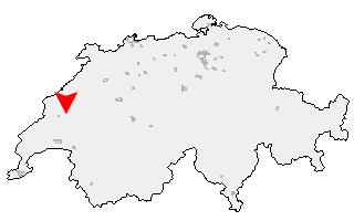
Suche
Ihre Position: Startseite - Waadt - Yvonand

Yvonand

Kategorie: Stadt / Gemeinde
Kanton: Waadt
Regierungsbezirk: District du Jura-Nord vaudois
amtlicher
Gemeindeschlüssel:

G5939
Einwohner: 2.278
Fläche: 133,80 km²

Postleitzahl (PLZ): 1462

Entfernung berechnen (zu einer anderen Stadt)
Yvonand bei Wikipedia   Yvonand bei Google Maps


Karte von Yvonand

Klicken Sie auf die Karte, um nach Städten im Umkreis zu suchen.
(Sie können die Karte auch in Ihre Internet-Seite einbinden.)

Fügen Sie in den HTML-Code Ihrer Seite einfach folgenden Code ein:
<a href="https://ch.postleitzahl.org/waadt/yvonand/" target="_blank"><img src="https://ch.postleitzahl.org/waadt/images/karte_yvonand.png" alt="Yvonand"></a>


Städte im Umkreis von Yvonand


Grandevent (12.23 km) Novalles (11.58 km)
Chamblon (10.87 km) Ependes (VD) (12.09 km)
Fontaines-sur-Grandson (12.25 km) Suchy (13.25 km)
Valeyres-sous-Montagny (10.09 km) Corcelles-sur-Chavornay (14.54 km)
Treycovagnes (10.39 km) Penthéréaz (16.32 km)
Montagny-près-Yverdon (9.93 km) Mauborget (12.54 km)
Giez (9.84 km) Fiez (10.43 km)
Goumoens-la-Ville (18.21 km) Villars-Burquin (11.26 km)
Belmont-sur-Yverdon (10.6 km) Romairon (11.35 km)
Vaugondry (9.38 km) Gressy (9.17 km)
Yverdon-les-Bains (7.91 km) Grandson (7.72 km)
Villars-le-Terroir (17.02 km) Essertines-sur-Yverdon (11.36 km)
Vuarrens (14.18 km) Fontanezier (9.23 km)
Champagne (7.89 km) Valeyres-sous-Ursins (8.52 km)
Ursins (8.57 km) Pomy (6.74 km)
Bonvillars (7.87 km) Sugnens (16.7 km)
Onnens (VD) (7.66 km) Pailly (11.48 km)
Fey (14.24 km) Orzens (8.91 km)
Cheseaux-Noréaz (3.82 km) Provence (11.89 km)
Cuarny (4.37 km) Oppens (9.38 km)
Villars-Epeney (3.43 km) Cronay (5.29 km)
Corcelles-près-Concise (7.05 km) Peyres-Possens (15 km)
Bercher (11.21 km) Boulens (12.99 km)
Bioley-Magnoux (8.13 km) Concise (7.93 km)
Mutrux (9.7 km) Donneloye (4.94 km)
Ogens (9.95 km) Vernay (1.93 km)
Montalchez (11.75 km) Prahins (6.63 km)
Chapelle-sur-Moudon (14.18 km) Yvonand (0 km)
Sottens (15.77 km) Correvon (8.7 km)
Saint-Cierges (11.89 km) Chanéaz (7.5 km)
Molondin (4.07 km) Vaumarcus (8.78 km)
Fresens (10.27 km) Rueyres (10.93 km)
Martherenges (15.01 km) Thierrens (10.23 km)
Saint-Aubin-Sauges (11.8 km) Démoret (5.45 km)
Rovray (2.49 km) Gorgier (13.69 km)
Chêne-Pâquier (3.91 km) Vuissens (7.45 km)
Rossenges (15.91 km) Chavannes-le-Chêne (3.74 km)
Denezy (9.22 km) Champtauroz (5.51 km)
Cheyres (4.19 km) Neyruz-sur-Moudon (11.57 km)
Moudon (14.34 km) Prévondavaux (8.52 km)
Villars-le-Comte (10.28 km) Treytorrens (Payerne) (5.48 km)
Murist (5.04 km) Bevaix (16.18 km)
Bussy-sur-Moudon (12.92 km) Châbles (6.34 km)
Chavannes-sur-Moudon (16.15 km) Oulens-sur-Lucens (11.31 km)
Combremont-le-Petit (8.31 km) Châtillon (FR) (7.52 km)
Combremont-le-Grand (7.25 km) Font (7.83 km)
Forel-sur-Lucens (10.45 km) Nuvilly (7.36 km)
Bellerive (VD) (14.6 km) Chesalles-sur-Moudon (15.77 km)
Lucens (12.14 km) Cremin (11.12 km)
Cheiry (9.13 km) Lully (FR) (8.59 km)
Curtilles (13.53 km) Sarzens (15.15 km)
Surpierre (10.58 km) Estavayer-le-Lac (10.8 km)
Les Montets (9.15 km) Sassel (9.46 km)
Brenles (16.8 km) Bussy (FR) (10.42 km)
Cugy (FR) (9.66 km) Dompierre (VD) (13.33 km)
Villeneuve (FR) (11.57 km) Lovatens (15.02 km)
Cerniaz (VD) (12.74 km) Sévaz (11.58 km)
Seigneux (13.22 km) Prévonloup (15.34 km)
Henniez (12.4 km)