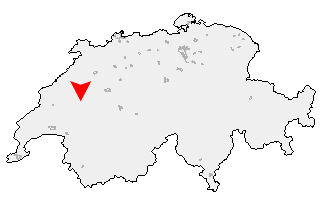
Suche
Ihre Position: Startseite - Freiburg - Ponthaux

Ponthaux

Kategorie: Stadt / Gemeinde
Kanton: Freiburg
Regierungsbezirk: District de la Sarine
amtlicher
Gemeindeschlüssel:

G2217
Einwohner: 488
Fläche: 59,20 km²

Postleitzahl (PLZ): 1772

Entfernung berechnen (zu einer anderen Stadt)
Ponthaux bei Wikipedia   Ponthaux bei Google Maps


Karte von Ponthaux

Klicken Sie auf die Karte, um nach Städten im Umkreis zu suchen.
(Sie können die Karte auch in Ihre Internet-Seite einbinden.)

Fügen Sie in den HTML-Code Ihrer Seite einfach folgenden Code ein:
<a href="https://ch.postleitzahl.org/freiburg/ponthaux/" target="_blank"><img src="https://ch.postleitzahl.org/freiburg/images/karte_ponthaux.png" alt="Ponthaux"></a>


Städte im Umkreis von Ponthaux


Marnand (12.67 km) Valangin (18.73 km)
Villars-Bramard (15.83 km) Saint-Aubin (FR) (13.69 km)
Chevroux (13.32 km) Villarzel (13.36 km)
Rueyres-les-Prés (11.25 km) Fétigny (10.59 km)
Romont (FR) (16.38 km) Trey (10.58 km)
Gletterens (12.8 km) Grandcour (10.78 km)
Payerne (8.31 km) Châtonnaye (10.88 km)
Vallon (10.29 km) La Folliaz (11.92 km)
Torny (8.73 km) Delley-Portalban (12.56 km)
Villaz-Saint-Pierre (12.66 km) Corcelles-près-Payerne (6.52 km)
Missy (8.7 km) Massonnens (14.69 km)
Montagny (FR) (5.1 km) Chabrey (13.5 km)
Corserey (6.72 km) Le Châtelard (16.29 km)
Dompierre (FR) (6.08 km) Chénens (9.07 km)
Villars-le-Grand (10.39 km) Villorsonnens (12.79 km)
Russy (4.23 km) Montmagny (11.41 km)
Prez-vers-Noréaz (4.57 km) Domdidier (5.64 km)
La Brillaz (6.13 km) Constantine (10.51 km)
Léchelles (2.56 km) Noréaz (2.39 km)
Cudrefin (15.16 km) Autigny (8.95 km)
Le Glèbe (11.83 km) Cottens (FR) (7.34 km)
Vallamand (12.9 km) Oleyres (4.22 km)
Avenches (7.53 km) Sorens (16.02 km)
Ponthaux (0 km) Mur (VD) (13.9 km)
Vuisternens-en-Ogoz (12.52 km) Avry (3.36 km)
Neyruz (FR) (5.88 km) Grolley (2.47 km)
Farvagny (10.52 km) Chésopelloz (2.27 km)
Haut-Vully (15.53 km) Faoug (9.79 km)
Autafond (2.23 km) Pont-en-Ogoz (14.15 km)
Villarepos (7.66 km) Misery-Courtion (4.96 km)
Matran (4.77 km) Clavaleyres (9.25 km)
Rossens (FR) (10.98 km) Greng (10.63 km)
Corpataux-Magnedens (8.99 km) Hauterive (FR) (6.97 km)
Belfaux (4.02 km) Corminboeuf (4.44 km)
Meyriez (12.41 km) Courgevaux (10.76 km)
Courlevon (9.58 km) Pont-la-Ville (13.73 km)
Wallenried (8.24 km) Arconciel (9.3 km)
La Sonnaz (6.12 km) Münchenwiler (11.72 km)
Givisiez (5.94 km) Villars-sur-Glâne (6.51 km)
Muntelier (15.29 km) Courtepin (8.15 km)
Cressier (FR) (11.21 km) Senèdes (11.26 km)
Granges-Paccot (7.27 km) Treyvaux (12.43 km)
Marly (8.89 km) Galmiz (17.52 km)
Salvenach (13.05 km) Murten (15.55 km)
Fribourg (8.55 km) La Roche (16.34 km)
Barberêche (9.79 km) Ferpicloz (11.68 km)
Jeuss (13.36 km) Lurtigen (15.37 km)
Villarsel-sur-Marly (11.33 km) Gurmels (12.75 km)
Staatswald Galm (14.66 km) Büchslen (17.36 km)
Pierrafortscha (11 km) Niederried bei Kallnach (10.19 km)
Le Mouret (14.15 km) Ependes (FR) (12.73 km)
Düdingen (11.4 km)