Rue
| Kategorie: | Stadt / Gemeinde |
| Kanton: | Freiburg |
| Regierungsbezirk: | District de la Glâne |
| amtlicher Gemeindeschlüssel: |
G2097 |
| Einwohner: | 948 |
| Fläche: | 111,90 km² |
| Postleitzahl (PLZ): | 1673 |
|
Entfernung berechnen (zu einer anderen Stadt)

|
|


| Kategorie: | Stadt / Gemeinde |
| Kanton: | Freiburg |
| Regierungsbezirk: | District de la Glâne |
| amtlicher Gemeindeschlüssel: |
G2097 |
| Einwohner: | 948 |
| Fläche: | 111,90 km² |
| Postleitzahl (PLZ): | 1673 |
|
Entfernung berechnen (zu einer anderen Stadt)
|
|
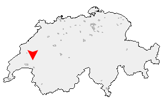
Klicken Sie auf die Karte, um nach Städten im Umkreis zu suchen. (Sie können die Karte auch in Ihre Internet-Seite einbinden.) |
Fügen Sie in den HTML-Code Ihrer Seite einfach folgenden Code ein: <a href="https://ch.postleitzahl.org/freiburg/rue/" target="_blank"><img src="https://ch.postleitzahl.org/freiburg/images/karte_rue.png" alt="Rue"></a> |
Städte im Umkreis von Rue |
|
| Pailly (14.86 km) | Fey (12.83 km) |
| Orzens (16.65 km) | Poliez-Pittet (10.21 km) |
| Belmont-sur-Lausanne (13.64 km) | Froideville (10.08 km) |
| Dommartin (10.32 km) | Naz (9.58 km) |
| Oppens (15.06 km) | Cronay (18.5 km) |
| Peyres-Possens (10.7 km) | Villars-Tiercelin (8.7 km) |
| Bercher (12.83 km) | Lutry (13.61 km) |
| Montaubion-Chardonney (8.92 km) | Boulens (11.15 km) |
| Bioley-Magnoux (14.93 km) | Donneloye (17.54 km) |
| Ogens (13.13 km) | Grandvaux (14.48 km) |
| Villars-Mendraz (8.02 km) | Savigny (9.77 km) |
| Corcelles-le-Jorat (6.84 km) | Montpreveyres (7.55 km) |
| Peney-le-Jorat (6.94 km) | Cully (14.1 km) |
| Prahins (15.4 km) | Riex (13.79 km) |
| Chapelle-sur-Moudon (9.08 km) | Sottens (7.8 km) |
| Correvon (13.28 km) | Saint-Cierges (10.5 km) |
| Ferlens (VD) (6.32 km) | Chanéaz (14.27 km) |
| Epesses (13.9 km) | Rueyres (11.04 km) |
| Forel (Lavaux) (9.57 km) | Ropraz (5.08 km) |
| Martherenges (7.5 km) | Hermenches (5.84 km) |
| Les Cullayes (6.75 km) | Thierrens (11.52 km) |
| Démoret (16.05 km) | Mézières (VD) (5.14 km) |
| Carrouge (VD) (4.17 km) | Vuissens (14.06 km) |
| Montet (Glâne) (5.22 km) | Rossenges (6.02 km) |
| Vucherens (3.66 km) | Syens (4.92 km) |
| Servion (5.17 km) | Rivaz (15.33 km) |
| Chexbres (14.3 km) | Denezy (12.34 km) |
| Puidoux (11.55 km) | Essertes (5.97 km) |
| Neyruz-sur-Moudon (9.94 km) | Ecublens (FR) (2.32 km) |
| Saint-Saphorin (Lavaux) (14.69 km) | Moudon (7.16 km) |
| Vulliens (2.4 km) | Chapelle (Glâne) (2.97 km) |
| Prévondavaux (13.54 km) | Villars-le-Comte (11.6 km) |
| Les Thioleyres (8.05 km) | Auboranges (3.21 km) |
| Vuibroye (4.55 km) | Granges (Veveyse) (9.55 km) |
| Châtillens (5.68 km) | Bussy-sur-Moudon (8.93 km) |
| Les Tavernes (6.55 km) | Oron-la-Ville (4.3 km) |
| Chavannes-sur-Moudon (5.52 km) | Oulens-sur-Lucens (10.88 km) |
| Rue (0 km) | Combremont-le-Petit (15.18 km) |
| Chardonne (13.57 km) | Forel-sur-Lucens (12.52 km) |
| Corseaux (15.44 km) | Palézieux (6.85 km) |
| Chesalles-sur-Moudon (6.85 km) | Vuarmarens (3.55 km) |
| Lucens (11.24 km) | Cremin (12.66 km) |
| Cheiry (16.02 km) | Oron-le-Châtel (4.72 km) |
| Curtilles (9.98 km) | Jongny (13.91 km) |
| Bossonnens (9.56 km) | Sarzens (8.33 km) |
| Surpierre (14.65 km) | Ursy (2.97 km) |
| Chesalles-sur-Oron (4.67 km) | Ecoteaux (7.74 km) |
| Attalens (11.16 km) | Brenles (7.2 km) |
| Corsier-sur-Vevey (13.48 km) | Dompierre (VD) (11.76 km) |
| Bussigny-sur-Oron (6.25 km) | Villeneuve (FR) (14.71 km) |
| Lovatens (9.81 km) | Le Flon (4.11 km) |
| Cerniaz (VD) (13.84 km) | Seigneux (13.7 km) |
| Maracon (7.77 km) | Prévonloup (10.78 km) |
| Henniez (15.48 km) | Remaufens (9.54 km) |
| Saint-Martin (FR) (5.62 km) | Siviriez (7.04 km) |
| Billens-Hennens (9.88 km) | Saint-Légier-La Chiésaz (14.55 km) |
| Mézières (FR) (10 km) | Villars-Bramard (13.24 km) |
| Villarzel (16.37 km) | Romont (FR) (12.44 km) |
| La Verrerie (7.86 km) | Blonay (17.5 km) |
| Vuisternens-devant-Romont (9.67 km) | Semsales (9.93 km) |
| Châtonnaye (18.33 km) | Châtel-Saint-Denis (13.8 km) |
| La Folliaz (16.9 km) | Villaz-Saint-Pierre (16.26 km) |