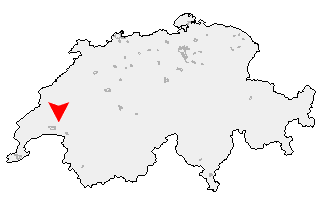
Suche
Ihre Position: Startseite - Waadt - Montpreveyres

Montpreveyres

Kategorie: Stadt / Gemeinde
Kanton: Waadt
Regierungsbezirk: District de Lavaux-Oron
KFZ-Kennzeichen: VD
amtlicher
Gemeindeschlüssel:

G5792
Einwohner: 373
Fläche: 41,10 km²

Postleitzahl (PLZ): 1081

Entfernung berechnen (zu einer anderen Stadt)
Montpreveyres bei Wikipedia   Montpreveyres bei Google Maps


Karte von Montpreveyres

Klicken Sie auf die Karte, um nach Städten im Umkreis zu suchen.
(Sie können die Karte auch in Ihre Internet-Seite einbinden.)

Fügen Sie in den HTML-Code Ihrer Seite einfach folgenden Code ein:
<a href="https://ch.postleitzahl.org/waadt/montpreveyres/" target="_blank"><img src="https://ch.postleitzahl.org/waadt/images/karte_montpreveyres.png" alt="Montpreveyres"></a>


Städte im Umkreis von Montpreveyres


Morrens (VD) (11.11 km) Goumoens-le-Jux (14.72 km)
Eclagnens (13.04 km) Jouxtens-Mézery (11.09 km)
Renens (VD) (11.56 km) Cheseaux-sur-Lausanne (10.4 km)
Suchy (18.35 km) Corcelles-sur-Chavornay (16.56 km)
Etagnières (9.82 km) Penthéréaz (14.54 km)
Bioley-Orjulaz (10.36 km) Romanel-sur-Lausanne (9.55 km)
Goumoens-la-Ville (12.5 km) Prilly (10.21 km)
Assens (9.16 km) Cugy (VD) (7.36 km)
Echallens (9.81 km) Le Mont-sur-Lausanne (7.43 km)
Bretigny-sur-Morrens (7.13 km) Villars-le-Terroir (10.94 km)
Essertines-sur-Yverdon (16.37 km) Vuarrens (13.29 km)
Bottens (6.79 km) Lausanne (6.27 km)
Poliez-le-Grand (8.26 km) Epalinges (5.73 km)
Sugnens (9.14 km) Paudex (9.05 km)
Pully (7.99 km) Pailly (14.06 km)
Fey (11.13 km) Poliez-Pittet (5.81 km)
Belmont-sur-Lausanne (6.71 km) Froideville (3.87 km)
Dommartin (7.67 km) Naz (4.62 km)
Oppens (15.33 km) Peyres-Possens (9.44 km)
Villars-Tiercelin (4.75 km) Bercher (13.07 km)
Lutry (7.44 km) Montaubion-Chardonney (7.24 km)
Boulens (11.14 km) Bioley-Magnoux (16.03 km)
Ogens (14.09 km) Grandvaux (9.08 km)
Villars-Mendraz (7.14 km) Savigny (3.45 km)
Corcelles-le-Jorat (2.4 km) Montpreveyres (0 km)
Peney-le-Jorat (4.97 km) Cully (9.05 km)
Riex (8.79 km) Chapelle-sur-Moudon (9.76 km)
Sottens (8.18 km) Correvon (15.25 km)
Saint-Cierges (12.07 km) Ferlens (VD) (1.25 km)
Epesses (9.45 km) Rueyres (13.12 km)
Forel (Lavaux) (4.86 km) Ropraz (4.12 km)
Martherenges (9.15 km) Hermenches (6.68 km)
Les Cullayes (2.21 km) Thierrens (13.93 km)
Mézières (VD) (2.44 km) Carrouge (VD) (3.54 km)
Montet (Glâne) (7.82 km) Rossenges (8.88 km)
Vucherens (6.01 km) Syens (7.9 km)
Servion (3.59 km) Rivaz (12.23 km)
Chexbres (11.31 km) Denezy (15.86 km)
Puidoux (8.88 km) Essertes (4.66 km)
Neyruz-sur-Moudon (13.66 km) Ecublens (FR) (6.02 km)
Saint-Saphorin (Lavaux) (12.12 km) Moudon (11.31 km)
Vulliens (6.76 km) Chapelle (Glâne) (5.14 km)
Villars-le-Comte (15.8 km) Les Thioleyres (7.14 km)
Auboranges (5.71 km) Vuibroye (5.8 km)
Granges (Veveyse) (8.37 km) Châtillens (6.13 km)
Bussy-sur-Moudon (13.66 km) Les Tavernes (6.82 km)
Oron-la-Ville (6.32 km) Chavannes-sur-Moudon (10.89 km)
Oulens-sur-Lucens (15.58 km) Rue (7.55 km)
Chardonne (12.3 km) Forel-sur-Lucens (17.41 km)
Corseaux (14.16 km) Palézieux (8.69 km)
Chesalles-sur-Moudon (12.91 km) Vuarmarens (10.48 km)
Lucens (16.65 km) Cremin (17.93 km)
Oron-le-Châtel (8.49 km) Curtilles (15.76 km)
Jongny (13.58 km) Bossonnens (10.59 km)
Sarzens (14.51 km) Vevey (15.77 km)
Ursy (10.5 km) Chesalles-sur-Oron (9.25 km)
Ecoteaux (10.22 km) Attalens (12.14 km)
Brenles (13.9 km) Corsier-sur-Vevey (13.98 km)
Dompierre (VD) (17.77 km) Bussigny-sur-Oron (10.27 km)
Lovatens (16.19 km) La Tour-de-Peilz (17.47 km)
Le Flon (11.08 km)