Bogis-Bossey
| Kategorie: | Stadt / Gemeinde |
| Kanton: | Waadt |
| Regierungsbezirk: | District de Nyon |
| amtlicher Gemeindeschlüssel: |
G5705 |
| Einwohner: | 847 |
| Fläche: | 24,40 km² |
| Postleitzahl (PLZ): | 1279 |
|
Entfernung berechnen (zu einer anderen Stadt)

|
|


| Kategorie: | Stadt / Gemeinde |
| Kanton: | Waadt |
| Regierungsbezirk: | District de Nyon |
| amtlicher Gemeindeschlüssel: |
G5705 |
| Einwohner: | 847 |
| Fläche: | 24,40 km² |
| Postleitzahl (PLZ): | 1279 |
|
Entfernung berechnen (zu einer anderen Stadt)
|
|
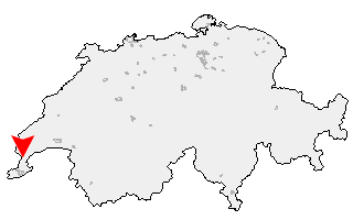
Klicken Sie auf die Karte, um nach Städten im Umkreis zu suchen. (Sie können die Karte auch in Ihre Internet-Seite einbinden.) |
Fügen Sie in den HTML-Code Ihrer Seite einfach folgenden Code ein: <a href="https://ch.postleitzahl.org/waadt/bogis-bossey/" target="_blank"><img src="https://ch.postleitzahl.org/waadt/images/karte_bogis-bossey.png" alt="Bogis-Bossey"></a> |
Städte im Umkreis von Bogis-Bossey |
|
| Puplinge (16.35 km) | Vernier (16.49 km) |
| Satigny (18.33 km) | Vandoeuvres (15.17 km) |
| Presinge (16.23 km) | Cologny (14.49 km) |
| Choulex (14.47 km) | Le Grand-Saconnex (13.5 km) |
| Meyrin (14.59 km) | Meinier (13.53 km) |
| Pregny-Chambésy (12.78 km) | Jussy (14.9 km) |
| Gy (13.93 km) | Bellevue (10.62 km) |
| Corsier (GE) (10.55 km) | Genthod (9.73 km) |
| Anières (9.59 km) | Collex-Bossy (9.37 km) |
| Versoix (8.49 km) | Hermance (8.26 km) |
| Mies (5.53 km) | Tannay (4.56 km) |
| Chavannes-des-Bois (5 km) | Coppet (3.93 km) |
| Commugny (3.56 km) | Founex (2.44 km) |
| Chavannes-de-Bogis (1.75 km) | Bogis-Bossey (0 km) |
| Céligny (1.47 km) | Crans-près-Céligny (2.77 km) |
| Arnex-sur-Nyon (2.51 km) | Crassier (2.38 km) |
| Borex (3.35 km) | Eysins (4.16 km) |
| Nyon (6 km) | La Rippe (5.82 km) |
| Signy-Avenex (5.07 km) | Grens (4.9 km) |
| Prangins (8.27 km) | Chéserex (6.59 km) |
| Duillier (7.75 km) | Trélex (7.65 km) |
| Gingins (7.51 km) | Coinsins (9.12 km) |
| Vich (10.14 km) | Givrins (8.88 km) |
| Gland (11.78 km) | Dully (12.74 km) |
| Genolier (9.89 km) | Luins (12.31 km) |
| Bursinel (14.4 km) | Begnins (12.29 km) |
| Saint-Cergue (11.38 km) | Vinzel (13.41 km) |
| Bursins (14.17 km) | Gilly (15.35 km) |
| Tartegnin (16.39 km) | Burtigny (14.89 km) |
| Le Vaud (15.15 km) | Essertines-sur-Rolle (18.48 km) |
| Arzier (15 km) | Bassins (15.47 km) |
| Saint-Oyens (18.67 km) | Marchissy (16.62 km) |