Borex
| Kategorie: | Stadt / Gemeinde |
| Kanton: | Waadt |
| Regierungsbezirk: | District de Nyon |
| amtlicher Gemeindeschlüssel: |
G5706 |
| Einwohner: | 865 |
| Fläche: | 20,10 km² |
| Postleitzahl (PLZ): | 1277 |
|
Entfernung berechnen (zu einer anderen Stadt)

|
|


| Kategorie: | Stadt / Gemeinde |
| Kanton: | Waadt |
| Regierungsbezirk: | District de Nyon |
| amtlicher Gemeindeschlüssel: |
G5706 |
| Einwohner: | 865 |
| Fläche: | 20,10 km² |
| Postleitzahl (PLZ): | 1277 |
|
Entfernung berechnen (zu einer anderen Stadt)
|
|
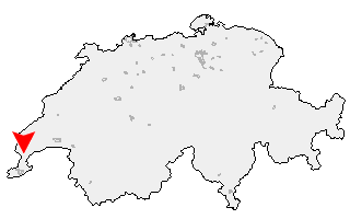
Klicken Sie auf die Karte, um nach Städten im Umkreis zu suchen. (Sie können die Karte auch in Ihre Internet-Seite einbinden.) |
Fügen Sie in den HTML-Code Ihrer Seite einfach folgenden Code ein: <a href="https://ch.postleitzahl.org/waadt/borex/" target="_blank"><img src="https://ch.postleitzahl.org/waadt/images/karte_borex.png" alt="Borex"></a> |
Städte im Umkreis von Borex |
|
| Meyrin (17.8 km) | Meinier (16.49 km) |
| Pregny-Chambésy (16.14 km) | Jussy (17.49 km) |
| Gy (16.56 km) | Bellevue (13.97 km) |
| Corsier (GE) (13.6 km) | Genthod (13.08 km) |
| Anières (12.43 km) | Collex-Bossy (12.63 km) |
| Versoix (11.83 km) | Hermance (10.74 km) |
| Mies (8.89 km) | Tannay (7.91 km) |
| Chavannes-des-Bois (8.18 km) | Coppet (7.03 km) |
| Commugny (6.91 km) | Founex (5.22 km) |
| Chavannes-de-Bogis (4.84 km) | Bogis-Bossey (3.35 km) |
| Céligny (3.41 km) | Crans-près-Céligny (2.92 km) |
| Arnex-sur-Nyon (1.44 km) | Crassier (1.29 km) |
| Borex (0 km) | Eysins (1.91 km) |
| Nyon (4.03 km) | La Rippe (4.63 km) |
| Signy-Avenex (2.12 km) | Grens (1.65 km) |
| Prangins (6.1 km) | Chéserex (3.87 km) |
| Duillier (4.9 km) | Trélex (4.32 km) |
| Gingins (4.25 km) | Coinsins (6.18 km) |
| Vich (7.17 km) | Givrins (5.54 km) |
| Gland (9.09 km) | Dully (10.19 km) |
| Genolier (6.64 km) | Luins (9.46 km) |
| Bursinel (11.87 km) | Begnins (9.22 km) |
| Saint-Cergue (8.51 km) | Vinzel (10.46 km) |
| Bursins (11.33 km) | Gilly (12.55 km) |
| Tartegnin (13.6 km) | Burtigny (11.73 km) |
| Le Vaud (11.84 km) | Essertines-sur-Rolle (15.56 km) |
| Arzier (11.69 km) | Bassins (12.12 km) |
| Saint-Oyens (15.6 km) | Marchissy (13.29 km) |
| Longirod (14.53 km) | Saint-George (16.25 km) |
| Gimel (18.41 km) | |